measuree is a browser-based tool for surveying applications based on oblique images.
Prerequisites for using measuree are a browser, an installed web server and aerial images that originate from a vertical or multi-perspective flight (vertical and oblique aerial images) with any aircraft (manned or unmanned).
Using measuree (see figure), complex surveying tasks can be solved in a browser-based software. Such tasks are typically performed by surveyors in the field or by stereoscopic measurements using specialized photogrammetric software and hardware in the office.
The four oblique views and the vertical view of the aerial photographs are visualized synchronously in the browser. By simply clicking on the object point, photogrammetric measurements are possible in the vertical and oblique images. This is done by identifying an object point in two or more images and blending the resulting lines of sight. Therefore, no photogrammetric expertise or ability to measure stereoscopically is required to carry out measurements on the computer.
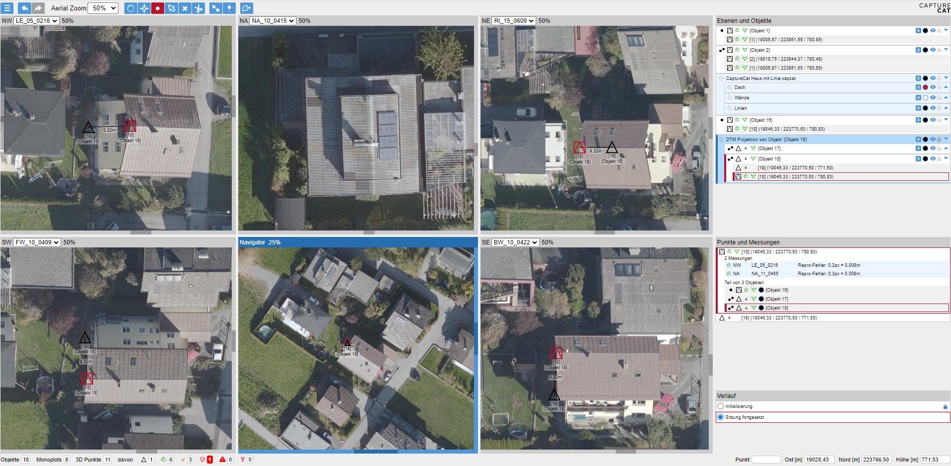
In the current version of measuree points can be measured and lines and polygons can be created from them. For each measured point there are two parameters that describe how accurately the measurement was carried out. These points can be combined into a layer, similar to graphics software, and displayed in a desired color. Auxiliary lines can be created in order to reach rooms that are not visible and building heights, for example, can be determined on-the-fly using these auxiliary lines. Various user-friendly tools (zoom, synchronous centering, window duplication, shortcuts, etc.) enable efficient work. The measured objects can then be exported and further processed in commercially available software.
Further information is available on the measuree Website.