Forest analysis
For several decades, airborne remote sensing has been increasingly used for forest mapping, monitoring and management.
In particular Hyperspectral sensors provide a wide range of information and applications in forestry by recording hundreds of spectral bands and providing detailed properties of objects. Different combinations of bands are used to calculate multiple indices that can be used to obtain information about biophysical properties of trees. This allows researchers, authorities and decision makers to gain insight into forest areas.
Some of the important applications of hyperspectral images in forestry are:
- extracting the forest borders
- recognition of invasive tree species, non-native in the respective ecosystem. Invasive species can displace native plant habitats and pose a threat to natural biodiversity.
- classification of tree species: the detailed observation of trees based on spectral signatures and the classification of the entire forest into different tree species can provide insights into species diversity and species distribution
- recognition of invasive tree species: Classification of non-native tree species in the respective ecosystem. Invasive species can displace native plant habitats and pose a threat to natural biodiversity.
- Recognizing plant physiological stress
- analysis of plant production and yield analysis
- Determination of senescence (ageing process), efficiency of photosynthetic activity and leaf pigment concentration
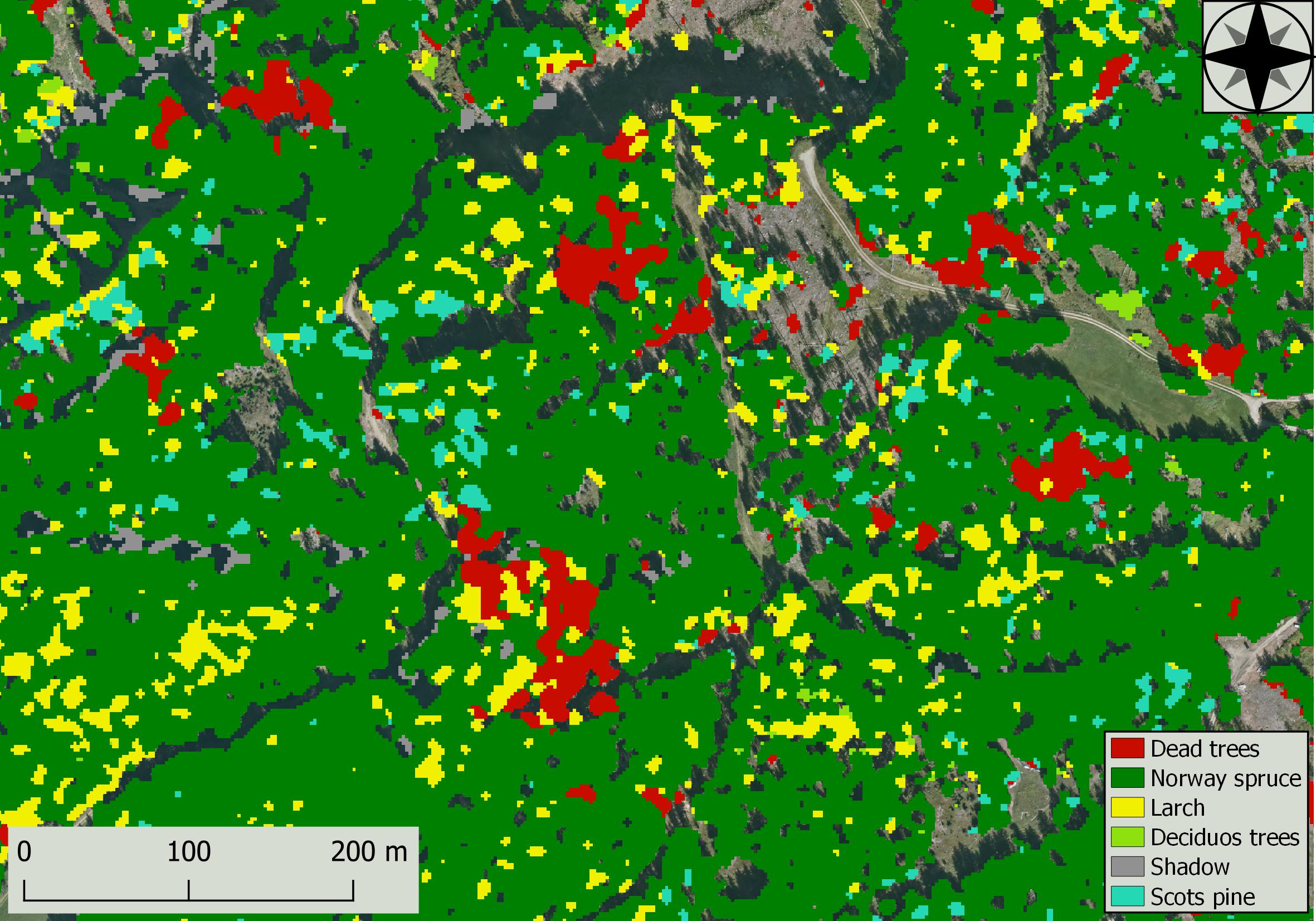
Tree species classification and recognition of dead trees
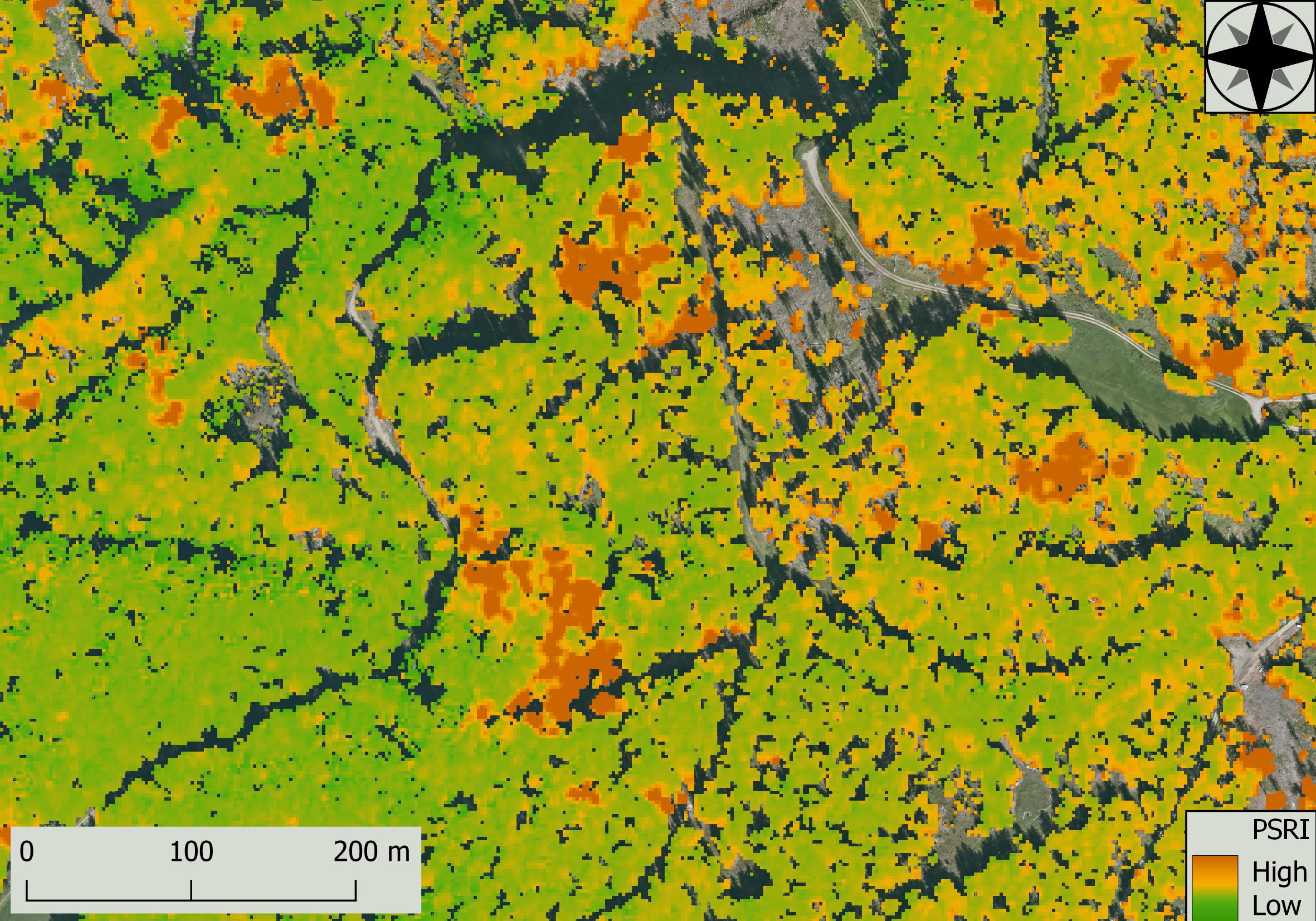
Plan Senescence Reflectance Index (PSRI)
An increase in the PSRI indicates an increased load on the leaf canopy (carotenoid pigment), the start of canopy ageing and the ripening of the plant fruit.
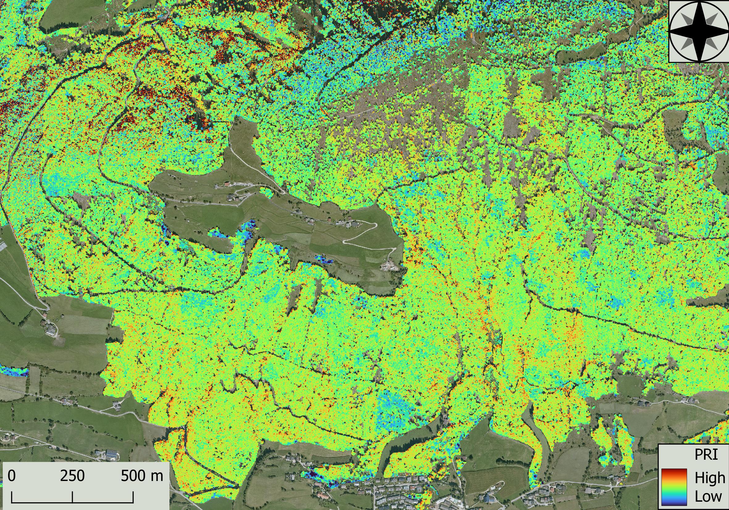
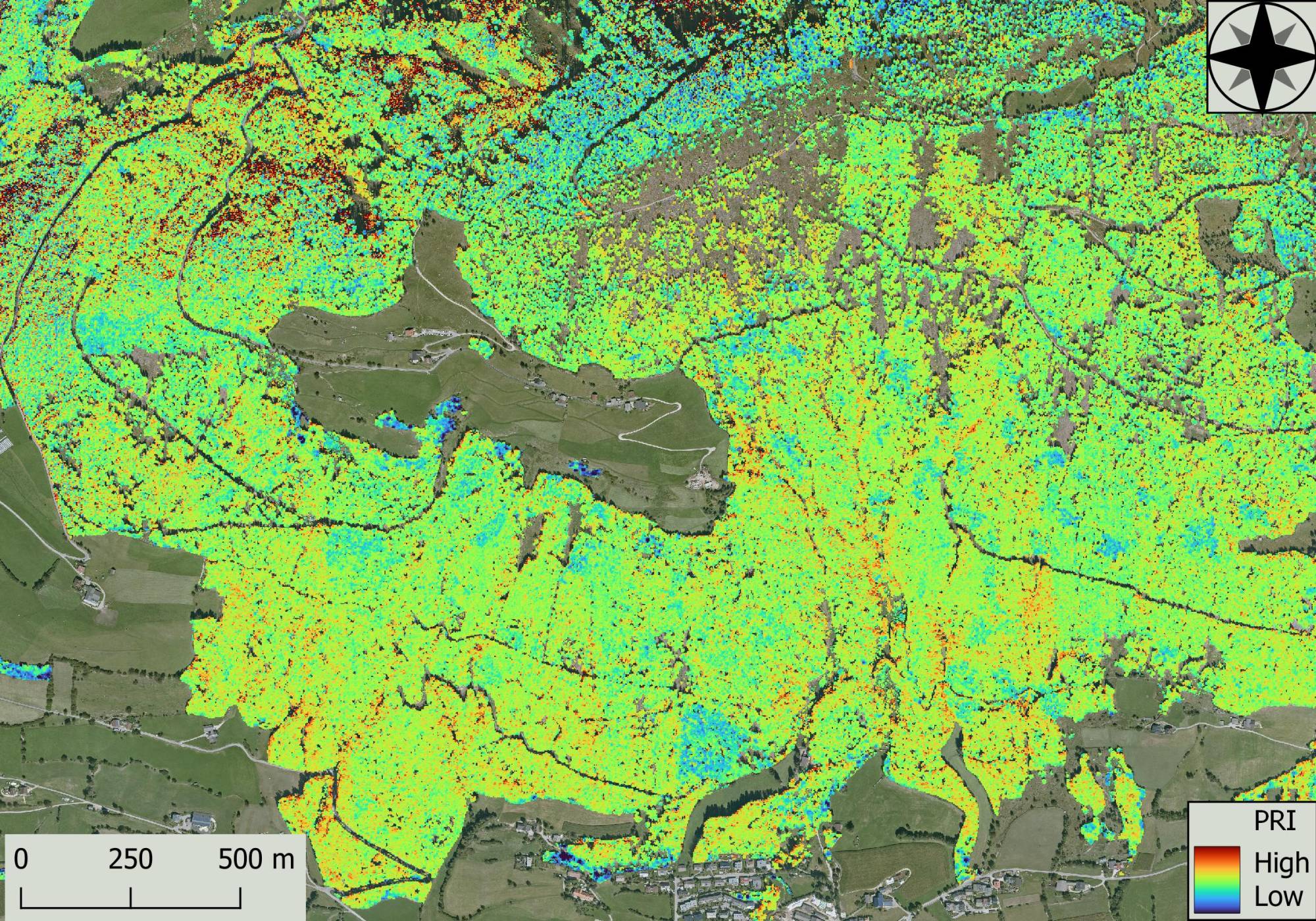
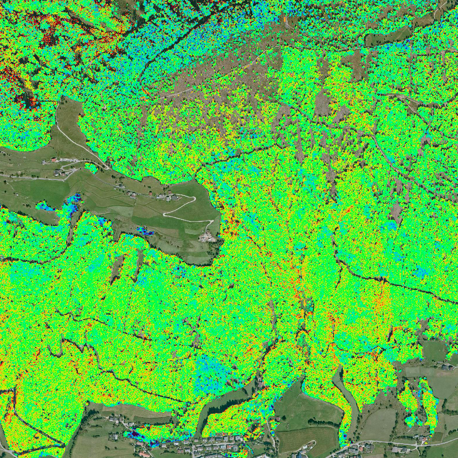
Photochemical reflectance index (PRI)
PRI is sensitive to changes in carotenoid pigments (leaf canopy) and is used in studies on vegetation productivity and to determine stress.