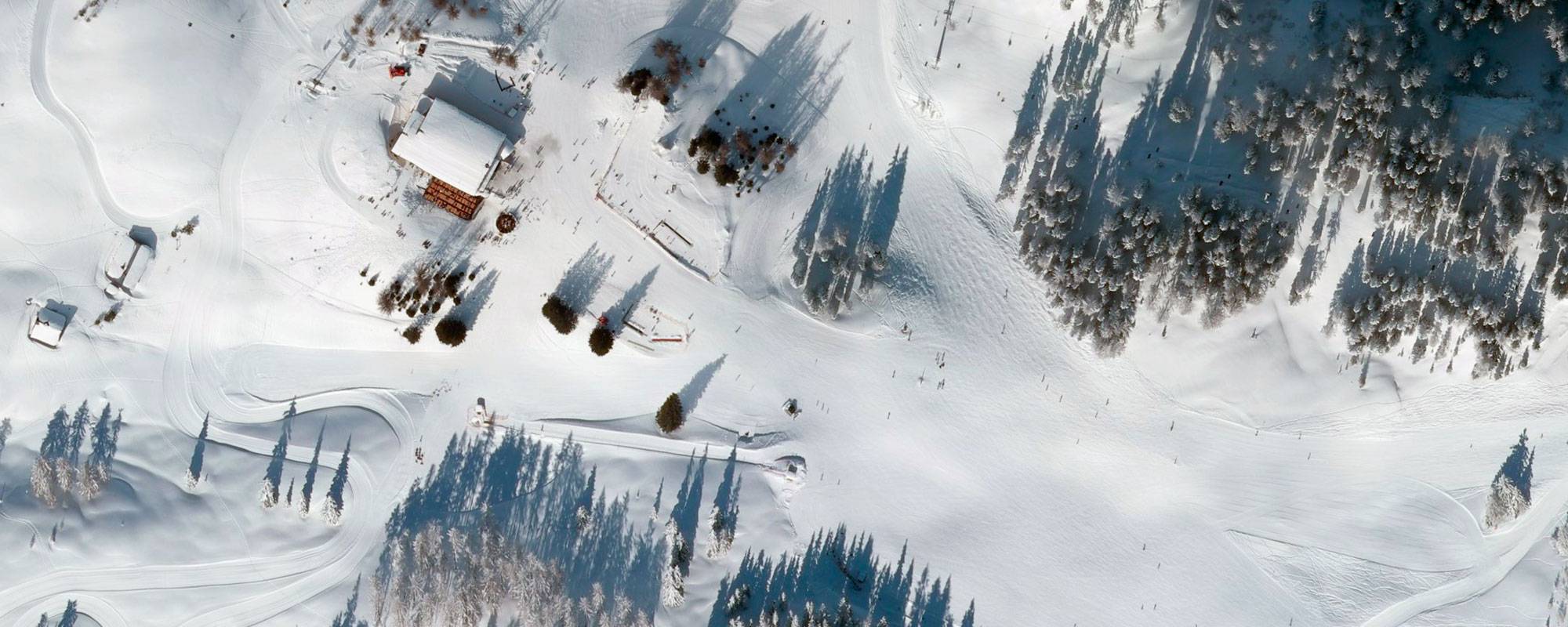
Winter Orthophoto
For some years now, we have been carrying out winter flights in the high mountains. Due to the position of the sun, these take place in February, with a cloudless sky and a blanket of snow from the valley to the mountain.
The application areas are versatile: on the one hand, for tourism purposes to create winter sports maps and to generate 3D applications of ski areas. These interactive 3D animations are created by the company 3D Reality Maps (https://www.realitymaps.de/) on the basis of our images. In addition, aerial photographs are also used for technical measurement purposes - for example, for calculating land-use taxes for cross-country ski runs and ski slopes. Orthophotos are used in the CAD/GIS systems of ski area operators and by planners as background data sets.

