
Urban remote sensing
Remote sensing from aerial imagery plays an important role in urban analysis by providing valuable information about the land surface, buildings, vegetation and ecological properties of the city. Photogrammetric aerial images, LiDAR or hyperspectral aerial images are combined with machine learning techniques to achieve best results.
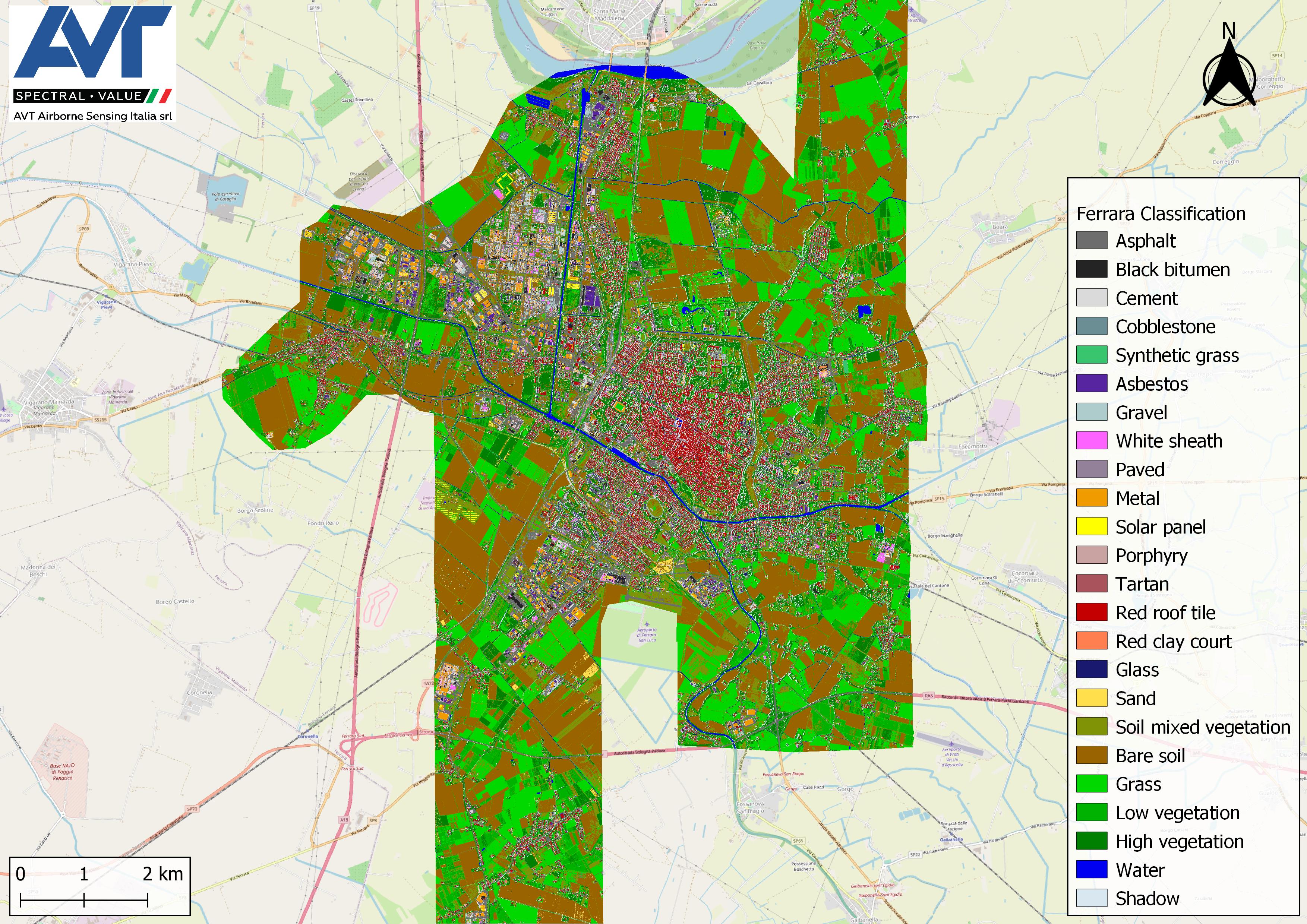
One of the key applications of remote sensing in urban areas is to have land cover classification, which is the basis for many analyses and studies.
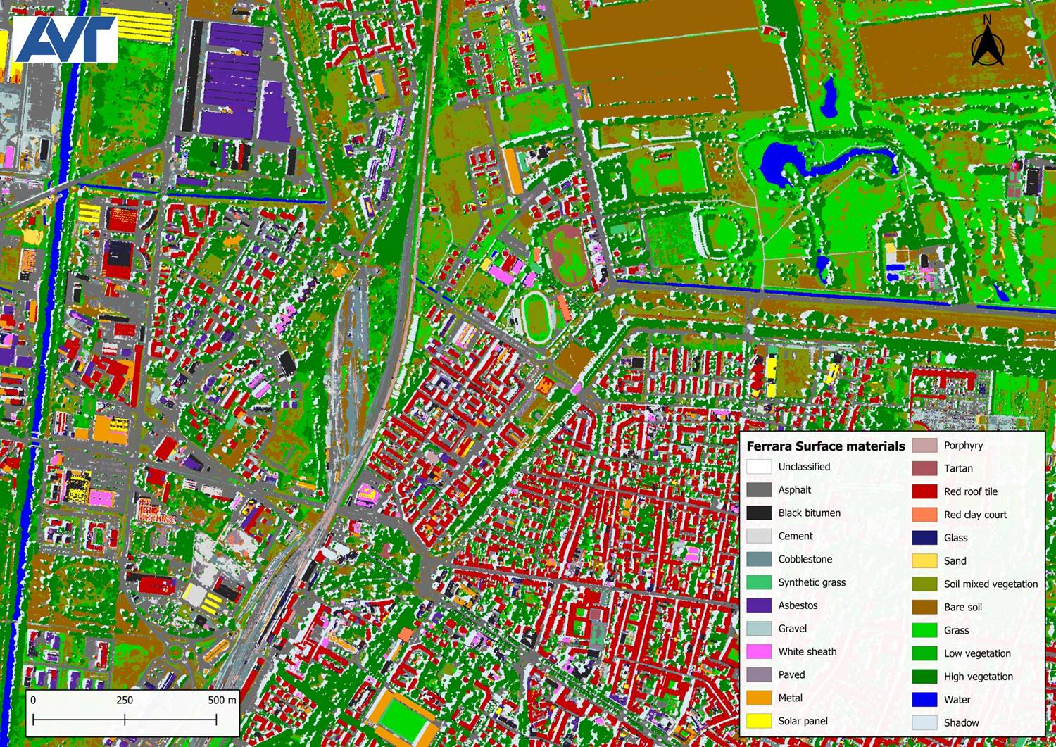
Orthophotos from multispectral aerial images allow us to map basic categories of land cover such as vegetated, non-vegetated areas and water bodies. Hyperspectral aerial images go a step further: through the hyperspectral signature of the materials, we can provide a detailed classification map with more than 20 classes on buildings, roads, pavements, vegetation, water bodies and bare soil.
Moreover, analysis can be done on vegetation and water bodies inside the urban areas.

Surface classification map (Graz, Austria)

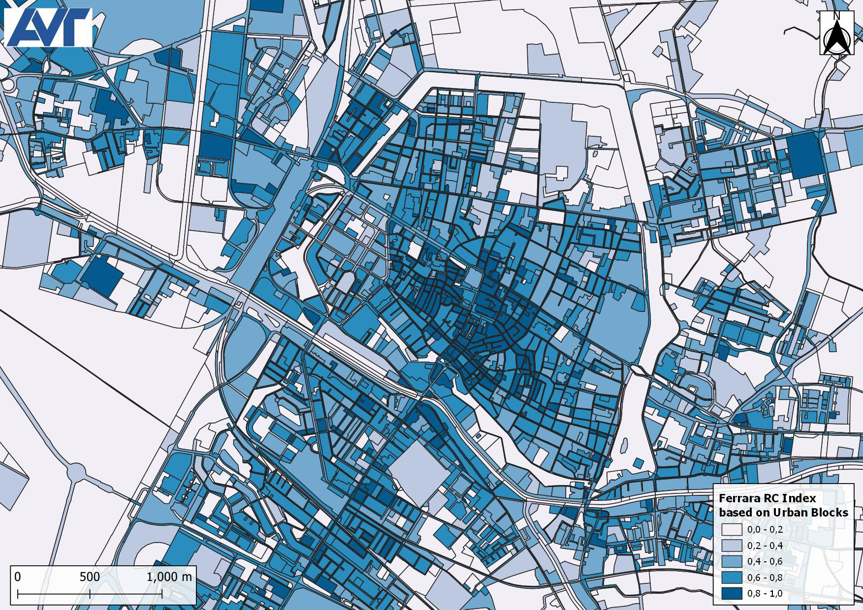
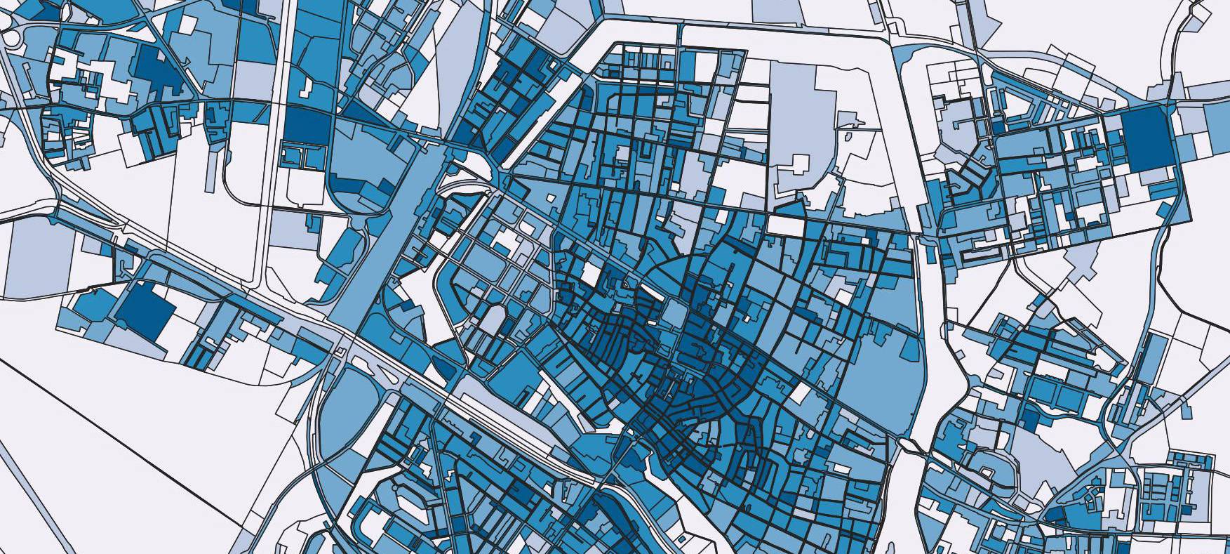
Integrated ecological index based on city blocks (Ferrara, Italy)

Water chlorophyll-a concentration index (Ferrara, Italy)
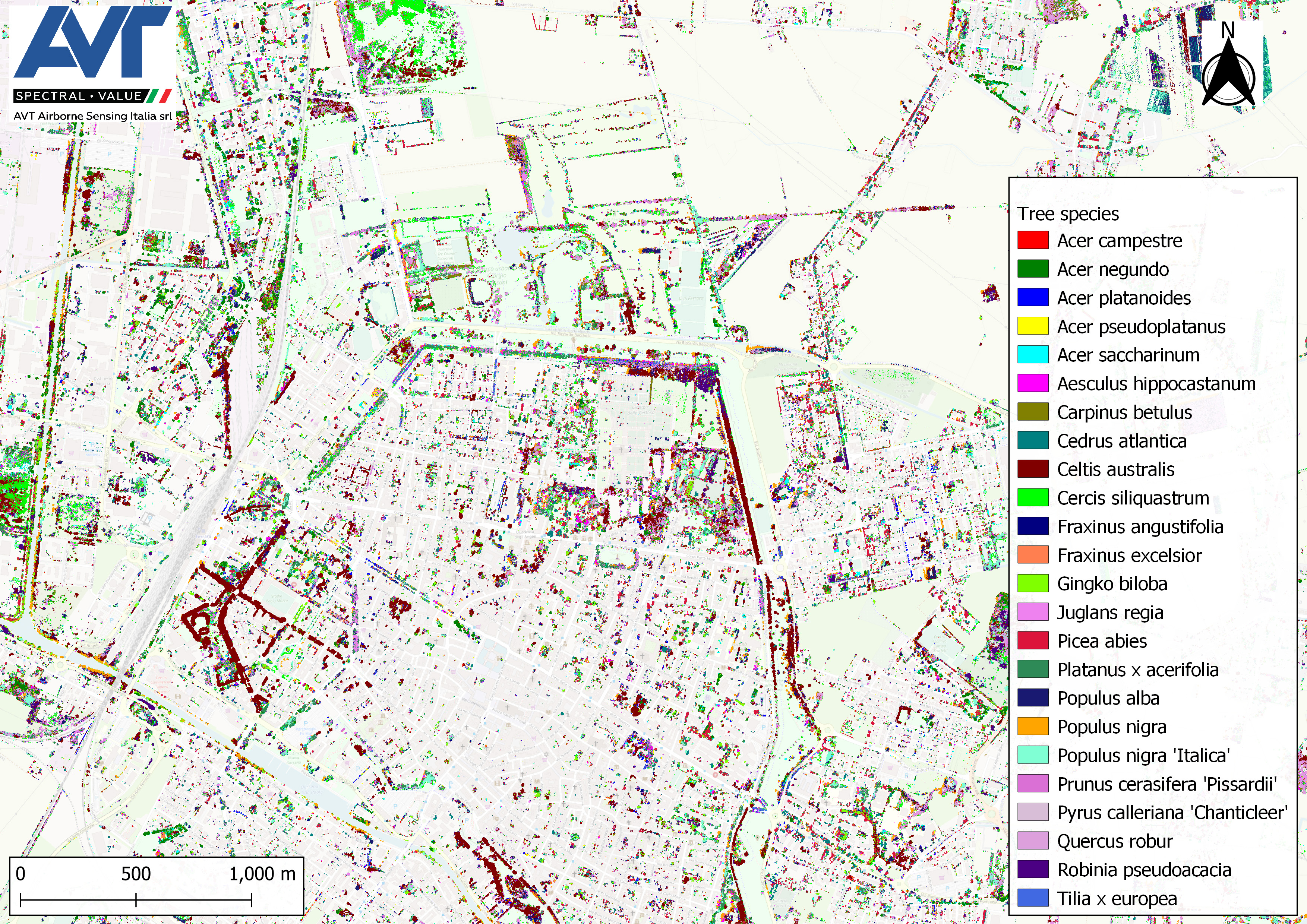
By detailed observation of trees based on spectral signatures, it is possible to create a tree species map. This map gives insight into the diversity and distribution of trees in urban areas.
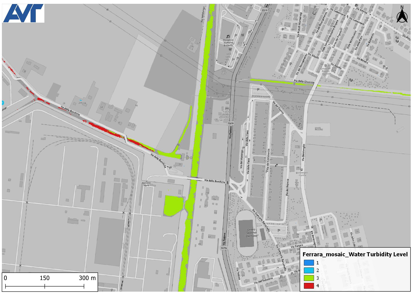
On the waterbodies, by recording the optically active water characteristics with the hyperspectral sensor, water quality can be assessed and analyzed regarding parameters such as turbidity and Chlorophyll-a concentration.
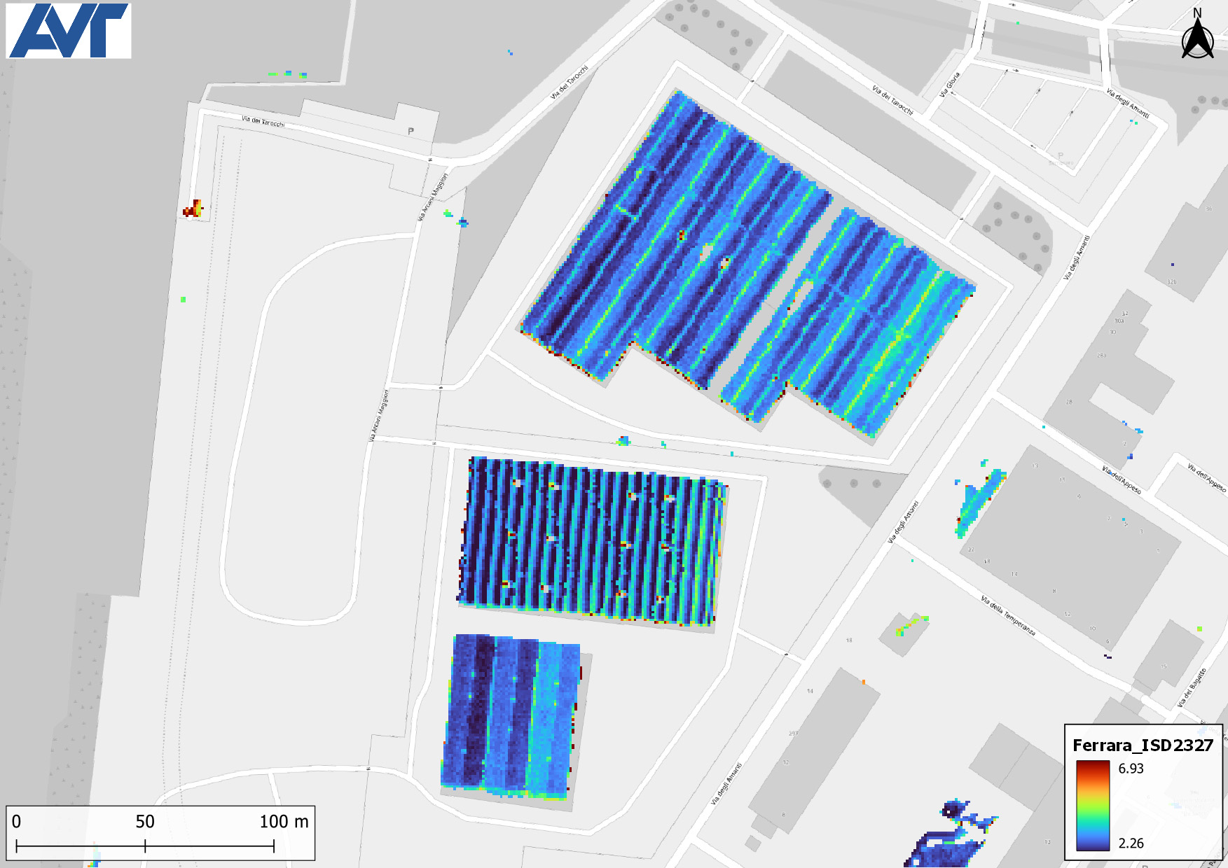
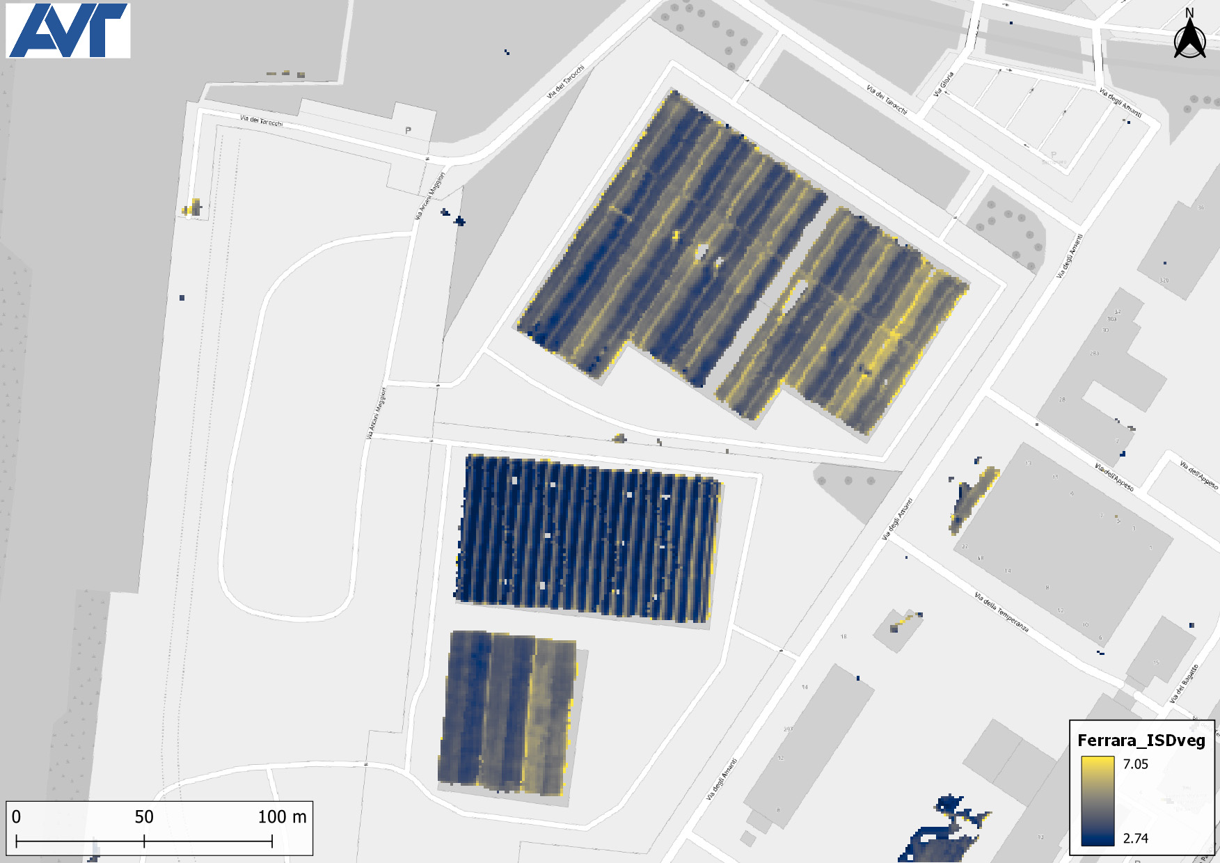
The detailed classification map can be used for further analysis, such as:
- Roof deterioration analysis, through the sensitive related bands and detection of moss presence
- Asbestos detection
- Vegetation density
- Building density
- Runoff coefficient on open spaces
- Surface imperviousness
- Surface permeability
- Surface infiltration
At AVT-AS we have developed the complete workflow for the planning and execution of the aerial flights and the generation of the final products, in the form of maps, raster or vector datasets and so on. For more information and reference projects, contact us!
Some results shown in the page are partly funded by the project USAGE - Urban Data Space for Green Deal through the European Union’s Horizon Europe Framework Programme for Research and Innovation under the Grant Agreement no 101059950 - call HORIZONCL6-2021-GOVERNANCE-01-17 (IA).