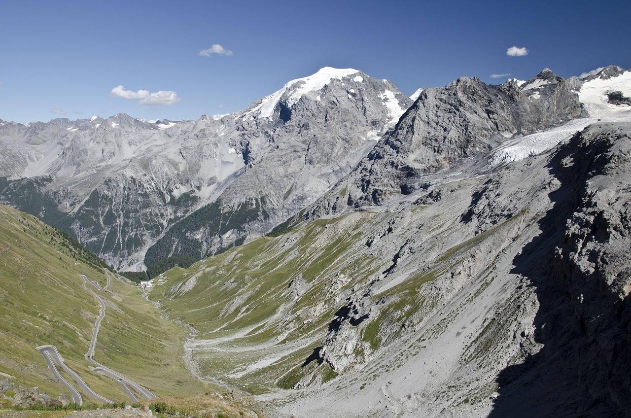
The Interreg project "MAP-Rezia" aims to strengthen the cross-border management of biodiversity in the protected areas on the borders between Lombardy, the province of Bolzano and the canton of Graubünden.
The results of the project will contribute to the development of common practices for the protection of ecosystems and will be crucial for the park management bodies, researchers and policy makers involved. They will contribute to the conservation of biodiversity in the area and disseminate information that is crucial for raising public awareness and enhancing the value of the area.
Partners of the project are AVT-ASI: ERSAF - Direzione Parco Stelvio, EURAC - Istituto per l'Ambiente Alpino, Free University of Bozen-Bolzano, Swiss National Park.

The project is funded by the European Union, the European Regional Development Fund, the Italian State, the Rotation Fund, the Swiss Confederation and the cantons as part of the cooperation program Interreg VI-A Italy-Switzerland - CUP E61G24000230007 co-financed.
The main objective of the Interreg VI-A Italy-Switzerland program is to promote investments in this area within the framework of four strategic priorities and the specific Interreg objective
- A smarter and more competitive Europe
- A greener Europe
- A better networked Europe
- A more social and inclusive Europe
- Better governance of cooperation
The project is developed in 4 work packages (WP) and includes the collection and harmonization of transboundary geodata, the analysis of biodiversity dynamics of large herbivore-forest-grassland relationships and forest modelling in relation to future climate change scenarios.
As part of work package 1 "Acquisition and processing of remote sensing data for the characterization of protected areas", AVT-ASI will contribute to the project by providing the skills and technologies to carry out hyperspectral and LiDAR imaging from the air over the Stelvio National Park and to process the data with remote sensing methods. The analysis of hyperspectral data will allow us to study the composition and distribution of plant species in forests and meadows, to define their characteristic features and to use the specificity of spectral signatures for accurate biodiversity mapping. The LiDAR data will instead be used to analyze the structural component of forest habitats (e.g. shape and volume, deadwood) related to biodiversity. The data obtained will be combined with in situ data to produce advanced indicators and metrics to describe plant ecosystem characteristics and assess biodiversity (WP2 and WP3).
In addition to the collection and processing of aerial image data, AVT-ASI will contribute to the dissemination of project results within the framework of work package 4 "Improving synergy between parks".
CUP: E61G24000230007
Project duration: January 2025 - June 2027
Status: Ongoing
Financing: Interreg VI Italy-Switzerland 2021-2027 (EUTC / EU funding / project)
Website: Interreg VI Italy-Switzerland MAP-Rezia
Instagram: Map-Rezia Account
We are also in Geomedia magazine: you can find the article at this Link .
AUGUST 2025: AVT Airborne Sensing has successfully carried out the aerial survey over the Stelvio National Park with the LiDAR sensor for 3D modeling of the territory.
The mountain environment posed significant challenges, starting from the technical aspect, due to the complex topography, sudden weather changes, the presence of wind at high altitude and turbulence, which significantly limited the time windows suitable for surveying. In addition to the technical difficulties, there are legal difficulties related to the specificity of the flight location on the border between states, which therefore have to take into account not only local or national but also international regulations.
Under these conditions, we have completed the work by adapting to the current conditions.
The aerial data collection is undoubtedly the most visible part of the work that AVT Airborne Sensing is carrying out as part of the Map-Rezia project, but from this moment on, a crucial phase begins that takes place „behind the scenes“: the processing of the collected data, which will then make it possible to carry out the analyses and studies foreseen by the project once it is completed.
Raw data must undergo a sophisticated transformation process in order to be used. This requires the use of highly specialized personnel and specific software.
AVT Airborne Sensing is proud to be an active part of this important project for the protection of biodiversity.
Operation co-financed by the European Union, European Regional Development Fund, the Italian State, Revolving Fund, the Swiss Confederation and the Cantons under the Interreg VI-A Italy-Switzerland Cooperation Programme.